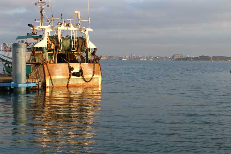
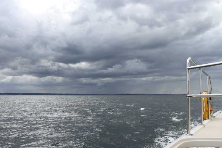
Richard and Andrea of Yacht Whileaway left for Paimpol as well click to enlargeWe had entered the Rivre de Tréguier in the rain, the mist and a F4, and we left the Rivre de Tréguier in the rain, the mist and a F4.
The weather
Reality was as forecast. A warm front was dithering over Tréguier casting its gloom in the form of mist and light rain, aided and abetted by a F4 from the N.
Pinch points
Being a locked marina, it’s easiest to enter Paimpol when the lock is on free-flow – open both ends – which occurs about an hour either side of HW.
The nav plan
Wanting to minimise the time we’d be directly exposed to the N wind, we planned to route through the Passe de la Gaine, passing south of Les Haux de Bréhat with its 48m high lighthouse before turning SSE through Chenal de la Moisie to the La Vieille du Tréou SHM.Leaving Treguier along the still waters of the river click to enlargeThence, SW to La Croix before turning E to route between the mainland and Ile de Bréhat whilst playing dodgems with the Vedettes that ply their trade between the two.
Once clear of the mainland, we’d turn S and head for the Chenal du Dénou and finally W along the long approach to the locked harbour of Paimpol.
With the journey taking approximately 4 hours, we’d leave Tréguier at 0810 to catch free-flow at Paimpol, at 1200.
The journey
Apart from being misty the whole way with a visibility of ½ mile, the journey was almost boringly uneventful. The sea’s emotions were in an irritated mood for about an hour after we’d left the Rivre de Tréguier but quietened soon after we turned SSE towards La Vieille.
Transiting these narrow channels can be a challenge to a chap’s sense of humour, but the whole journey was ‘plain sailing’ if a motor boater is allowed to use such a phrase.We saw many more fish farms along the river click to enlargeOverall, the tidal effect was more positive than we’d planned and we gained 22 minutes.
Arriving
We’d met a couple from Yacht Whileaway whilst in Tréguier and their plan was also to move to Paimpol, today. However, last night they moved up river and anchored to shorten their journey. Given their departure time we were confident we’d overtake them en route, but this was not be.
In the Chenal du Dénou we hailed them on Ch16. Changing to Ch77, I asked where they were. ‘Just entering the main approach channel to Paimpol,’ came the reply. They’d beaten us! How could that be? They must have set off earlier than planned. Hmmm.
However, we remain friends, and they’re coming around for a glass or three this evening.
The tecky details
We passed just to the south of Les Haux de Bréhat click to enlargeDeparted Tréguier – 0810
Arrived Tréguier – 1335
Time on passage – 3hr 25min
Total planned distance – 26.1nm
Tide: 2 days before Neaps
Longest leg – 3.9nm La Croix to Cadenenou NCM (pilotage)
Tech issues – nil
Incidents – Why do the French seem to leave their lobster pots right in the middle of the smallest navigation channels?
Navigational info: Given the strong tidal flows through Tréguier’s pontoons, it’s best to be pointing into the current when leaving.
Piers and Lin
From the Nav Table of Play d’eau
Fleming 55
You can get in touch with us any time by using our Contact Form.
A recently repainted La Croix in the Entrée de la Riviere de Trieux click to enlarge
Passing close to Denou in the Chenal du Dénou before turning west on final approach to Paimpol click to enlarge
Treguier, on the north coast of Brittany, was founded in the sixth century and still has many ancient buildings click to enlargeUpdate 3 November 2017
Jean-Jacques Furet, Harbour Master, Treguier, has pointed out some major marina improvements to the following report I made in 2013. Please read his comments which are almost at the bottom of this page.
Report dated 11 September 2013
Tréguier, on the north coast of Brittany, is one of our favourite places in which to while away a few days absorbing the beauty and stillness of a river marina and walking around the small town with its many ancient buildings dating back to the sixth century.
Hot chocolate (large) in the square sitting opposite the 14th century cathedral is de rigueur as one contemplates the difficult decision of which boulangerie to choose for your next supply of croissants.
So what was wrong with the old marina?
In a strange way, the ‘oldness’ and ‘unkemptness’ of the pontoons was one of Tréguier’s attractions. You felt something of an explorer visiting a little known and hidden away marina.
Yet, the ravages of years had taken its toll. Piles were rusted through becoming a lattice-work of holes joined by flakes of rust. Fingers were too small, too flimsy and insubstantial for many visitors and stories of fingers breaking away drifting downriver complete with yacht attached can still be heard on the jungle drums.The cathedral in Treguier’s square click to enlargeDespite these inadequacies, visiting boaters kept returning, the beauty of tucked away Tréguier more than compensating for the marina risks.
That’s precisely why we kept coming back with Play d’eau, mooring up to the first or second hammerhead with its desperately suspect fingers, but having heard the distant jungle drums we would run additional warps stretching to more secure points back along the main pontoon.
So what’s new – what’s changed?
Major work has been carried out over the last year of so to revamp the marina. For example,
Every pile has been replaced.
Every piece of rotten and bent pontoon boarding has been replaced.
The Capitainerie’s office is new and in the marina building opposite Pontoon E’s walkway
Video surveillance is throughout the marina
The bar and marina restaurant (Le Pontoon) has had a facelift and serves good food.
…and for the arriving boater,
The first pontoon (E) now has a very substantial 30m x 2.5m pontoon in place of its old hammerhead.
Eight new and substantial 10m fingers have been installed on the north side of E.
The first three pontoons (E, D, C) offer the visitor berths.
A new 30m hammerhead on pontoon E. Remember to have your fenders set high. Play d’eau looks dwarfed! click to enlarge
55 visitor berths accommodate boats lengths up to approximately 15m max.
Visitor berths have 16A electricity supplies and water
Visitors can reserve a berth by calling the HM on his mobile 0033 (0) 6 72 70 70 20
Tréguier Marina
Tréguier marina is 5nm up the beautiful Rivre de Tréguier which has some lovely and protected places in which to anchor.
42nm to the west is Roscoff, 53nm NE will find you in Beaucette Marina Guernsey, to the east by 28nm is Paimpol and St Malo at 58nm, whilst Plymouth is 100nm to the NNW.
Access to the marina is 24/7, regardless of tide. Speed limits are 5kts reducing to 3kts in the marina. Along the river you’ll pass fish and shell fish farms and I’d advise keeping speed back to 3kts even if just to keep people happy.The Capitainerie is in the main building opposite Pontoon E’s walkway click to enlargeWi-Fi is free from Netabord. If you don’t already have a code, ask at the HM’s office and car hire and taxis can be arranged through the HM office as well.
Diesel is available from the N side of pontoon E, limited from HW slack to LW slack, but not during the flood tide.
The private firms which have been operating by the marina for many years all appear to have grown and offer just about every facility you may need. Lift out (21 tonne max), mechanics, GRP work, as well as considerable amounts of storage ashore, either covered in large sheds or out on the hard standing.
The ancient three floored chandlery just over the bridge has had an extension built and every nook and cranny of the whole building bulges with chandlery and clothing. I don’t recall having seen such an vast array of boaty bits in one place.
Lin and I spent ages just looking, whilst the smell of tarred twine evoked childhood memories of looking around Jersey’s St Aubin’s chandlery with Dad in the late 1950s and early 1960s, and before you say it, yes, I’ve recently qualified for my old age pension….
Provisioning
The chandlery ‘over the bridge’ bulges with equipment from floor to ceiling – literally click to enlargeThere’s a huge farmers’ market on Wednesdays from 0900-1300, every week of the year, which stretches from the marina hardstanding right up into the town’s square. As someone has previously commented, you can buy anything from a day old chicken to a ten year old Calvados.
As well as the many shops in the square, I’m told there’s a Super-U on Boulevard Jean Guehenno, up the steepish hill from the Pont Canada roundabout about 1.6km SW of the marina. Walking back down the hill is much easier of course!
Le Ponton – the Marina’s bar and restaurant
After a period of absence, the marina restaurant is back up and running with a clever ‘pirate’ décor which we have to admit, is really well done.
Our first meal at Le Ponton was capped off by a glass of Venezuelan rum which the Chef Proprietor M. Porgré-gilles, presented to Piers. With rum as Piers favourite tipple, he was surprised by its richness and elegance and promptly bought a bottle the next day. How long it will last is another question altogether.
You can reserve a table by calling – 0033 (2) 96 92 41 08.
Three words of caution
The first and third SHMs are lit. The second, which reaches into the channel, isn’t. More than one yacht has hit it on approach at night click to enlargeThe first regards the final approach to the marina for which there are three green SHMs. The first and last are lit. The middle isn’t. If you follow the line between the first and third green at night, you’ll probably hit the middle SHM since it’s bang (literally) in your way in the channel.
A visiting yacht had done just that when we arrived and was having its bows repaired where the GPR had been damaged.
The second concerns the tidal flow which can move through the pontoons just as quickly, if not quicker, than that at Roscoff. It’s emphasised by the HM that mooring should only ever be attempted into the current.
The third concerns the debris the river picks up especially at spring tide and which can so easily foul your sterngear. Always check all is clear before casting off – it can save a good deal of embarrassment – see the photo below.
Our thanks for much of this information must go to HM, David Peron, who speaks such good English.
Piers and Lin
from the Nav table of Play d’eau
Fleming 55
You can get in touch with us any time by using our Contact Form.
Spring tides wash debris down river. The HM is towing a 25′ tree trunk found wedged across the transom of a yacht click to enlarge
The flood and ebb tides are very strong and flow through the pontoons diagonally. Always moor into the current click to enlarge
Low tide at the marina makes it a challenge to climb the walkways click to enlarge
At high tide walkways are easy click to enlarge
The chandlery is bursting at the seams from floor to ceiling – literally click to enlarge
The magnificent chandlery is just over the Treguier’s bridge click to enlarge
Let’s call this leg, ‘Never poke your tongue out at the rain’.
The weather
The cold front hovering over Roscoff and the Bay of Morlaix, its rain showers clearly visible click to enlargeThe last few days of our week’s stay in Roscoff had seen thick fog which didn’t really clear until after lunch, leaving the air cold and damp.
In contrast, today was a clear day. The forecast showed a fairly consistent W’ly F3/F4 which would push us on our easterly route to Tréguier.
The synoptic chart showed something else (see below).
An area of low pressure had been hanging around to the NW of France, leaving an elongated warm and cold front stretching in an almost straight line down the coast of Norway, though central England to graze the NW coast of France before turning into the Bay of Biscay.
It would reach Roscoff as a cold front sometime around midday as it made its way slowly eastwards. The question was how developed was the front? Would it be producing downdrafts, squalls, and heavy rain?
Pinch points
Looking south towards Tréguier five hours later. This same rain storm had stalked us from Roscoff and was waiting to mug us as we entered the Rivre de Tréguier click to enlargeThere were no pinch points as such, but we wanted to ensure we had the wind and tide with us, meaning a following wind and a tide that carried us to Tréguier.
The nav plan
Tidal streams showed we should be entering the channel between Les Sept Îsles and mainland around HW Brest -3½. At this point, the tide would be almost slack after which it would carry eastwards along the coast and upriver to Tréguier.
The journey
As we left Roscoff in sunshine, we could see the cold front to the west.
By the time we were half way across the Bay of Morlaix the front was a solid messy mass of cumulus over Roscoff and it had started to block the sun from Play d’eau. You could see where it was dropping its rain.Tracking these showers on radar showed they were either staying over the land or moving north, albeit very slowly. They’d miss us. Ha!Approaching the Rivre de Treguier, the cloud burst over us as though to say ‘Gotcha’ almost obliterating visibility. Taken from inside the Pilot House! click to enlargePassing by Les Sept Îsles we encountered short term F6 squalls. The largest shower we’d be tracking was almost abeam us but still over the land. In my mind, I poked my tongue at it as I said, ‘You didn’t manage to get us.’
Famous last thoughts. As we tracked south from the Basse Crublent PHM to the mouth of the river de Tréguier, it passed overhead, its rain almost obliterating visibility. But by the time we’d passed La Corne, the rain had all but stopped and we had a beautiful 5nm trip up river, with magnificent cloud displays all round.
Arriving
We arrived as the tide was almost at its highest, with only a half knot flow. Seeing the brand new 30m hammerhead, we turned, headed into the tide, moored up, and settled down to dinner and to watch the finals of Masterchef.
Incidents
The rain was so heavy it beat the sea into submission click to enlargeAfter so many incident-free legs, this one had two.
The first was the pressure switch on the compressed air tank which failed to shut down the compressors as full pressure was reached. Just as we were casting off, the pressure relief valve blew with an almighty bang followed by a huge rush of escaping air. I’d be telling porky pies if I said I didn’t jump.
The second was as we were passing Les Sept Isles. I’d been watching two fisherman becalmed in their Merry Fisher ahead and to port. Suddenly, they opened their outboard’s throttle and steamed straight at us on an intercept.
Five blasts on the Kalhlenbergs did nothing to alter their apparent determination to hit us. By now I see into their small cockpit. The skipper wasn’t looking to see where he was going, he was turned away talking with his friend. Maybe the noise of his outboard was drowning even the 143dB Kahlenbergs.Ten minutes after it started, the downpour stopped just as we passed Le Cornu, leaving perfect visibility click to enlargeHaving already disengaged forward power I engaged reverse and ‘Kahlenberged’ them with a long blast. Just before cutting in front of me and only about 30m away, the skipper must have heard and suddenly looked up. His mouth dropped open, he slammed his out board into reverse and pirouetted to port and away from us, giving me a ‘Gallic’ shrug as though to say ‘Pas de problème.’
My thoughts at this point are unprintable. After 25 years of boating, I was amazed at how suddenly and quickly the situation had developed.
The tecky details
Departed Roscoff – 1225
Arrived Tréguier – 1810
Time on passage – 5hr 45min
Total planned distance – 42.4nm
Tide: Springs
Longest leg – 12.9nm from West of Les Sept Isles channel to Basse Crublent PHMMoored in Treguier on the new 30m hammerhead. Taken the next day as Lin was hanging the washing out click to enlarge
Tech issues – One – see above
Incidents – One – see above
Navigational info: There’s a strong tidal flow at 45 degrees across Tréguier’s marina pontoons just waiting to catch you out!
Piers and Lin
From the Nav Table of Play d’eau
Fleming 55
You can get in touch with us any time by using our Contact Form.The synoptic chart for 0001 on 6 September 2013 click to enlarge
Roscoff’s Bloscon marina. The commercial port and marina entrance are on the left of the picture click to enlargeReport dated: 6 September 2013
Bloscon is already a great marina, and next year will be simply superb. Here’s why.
An interview with M. Frédérie Boccou, Maître du Port
Frédérie spent forty minutes with me unravelling the creation of the Bloscon complex, and detailed the next and last developments to bring the marina to completion by May 2014.
The vision was that for €52m, Roscoff’s ferry and fishing ports would be expanded and modernised, and a new marina created.
Roscoff’s Bloscon marina is perfectly located on the north coast of Brittany. It’s 15nm from Trébeurden to the east. To the west it’s 34nm from L’Aber Wrac’h and 67nm from Brest. To the north, it’s 95nm from Plymouth and 75nm from the popular Beaucette Marina, Guernsey.M. Frédérie Boccou, Maître du Port, Roscoff click to enlargeAs well as being an ideal transit marina, a growing number of British owners are locating their boats to Bloscon permanently to save Channel crossings and marina fees; there’s so much to explore along the north coast, and for the more adventurous Brittany’s inviting west coast beckons, strongly.
Roscoff – a small town of character
The small town of Roscoff is a mile away. Its ancient buildings and small one way roads are a delight and restaurants, créperies, boulangeries (fresh croissants galore!), and small hotels abound.
Food ingredients are mainly available from the two out of town supermarkets. However, for those in Roscoff on a Wednesday morning, there’s a comprehensive farmers’ market.
Bloscon marina details – today
Marina staff are on the water in their RIBs from 0700 to 2100 click to enlargeBloscon marina’s telephone number is 0033 (0) 2 98 79 79 49. All staff are fluent in English and extremely helpful. Note: Reeds Nautical Almanac details the wrong telephone number.
Berthing costs are almost the least expensive on the north and west coasts of France, whether visiting or looking for half or full year contracts.
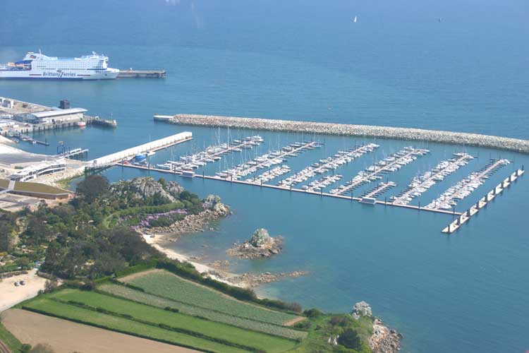
There are 625 berths, plus an additional 45 dedicated for visitors on the south side of pontoon B and north side of pontoon D. Thirteen berths are adapted for those with physical disabilities.
The marina’s minimum depth is 4m, regardless of tide.
Marina buildings currently house a chandlery (mainly selling clothing and fishing tackle and some basic boating items), a sandwich bar from which bread and croissants can be pre-ordered, and car and bicycle hire.
10,000 square metres of hard standing is available for storage ashore and there’s a 20m x 100m slipway to the water.Bloscon’s pontoons have rubbing strakes to protect boats click to enlargeThe marina’s large car park offers free parking.Wi-fi is also free, yet the one aerial which services the marina currently struggles to cope.
A 50 tonne travel hoist is available. The only other hoists of similar or greater lifting capability are at M&G St Sampson’s Guernsey, Jersey, Brest and St Malo.
Pontoons
The 4m wide walkway takes you from the marina buildings down to two main pontoons. The one straight ahead and against the new concrete breakwater is 100m x 4m, and is reserved for large vessels and superyachts. Its electricity supply is both 16A and 32A.
At right angles to this is another 4m wide walkway with two toilet blocks. This pontoon has nine further pontoons, A to I inclusive, all with substantial 12m fingers which are untypically French; they don’t sink when you stand on them – I’ve jump and bounce tested them.The delightful town of Roscoff is full of ancient buildings click to enlargeFingers and pontoons have high impact plastic protective inserts to prevent yacht damage. 16A electricity and water supplies are available to all as are substantial cow-horn cleats.
The service pontoon sports a fuel berth with a 24/7 diesel pump which accepts UK credit cards, an oil disposal unit, and a black tank pump out and flush facility.
Note that water is supplied from the new style connectors now appearing in so many marinas. These adaptors are (thankfully) available for purchase from the HM.
Approach
Just like Jersey’s St Helier marina, the approach to the marina is through the commercial ferry port where international lights control all movements.
The first set controls entry and transit through the commercial area to the marina. The lights are on the north side of the Lemaire commercial breakwater and display green over white over green when ferries are manoeuvring, prohibiting entry.
The second set controls exit from the marina and are at the marina’s entrance by the starboard hand marker. Three reds forbid exit.
Only the marina’s north entrance is to be used. The southern entrance should not be attempted where there are unchartered rocks and shoals. ‘Captain’s own risk,’ as Frédérie said.
In the marina
Alexandre Dumas of the Three Musketeers fame lived here in Roscoff for the summer of 1869 whilst he wrote his chapter on the onion in his Great Dictionary of Cuisine click to enlargeMarina RIBs with 30hp and 70hp outboards are constantly on the water between 0700 and 2100 to help visitors to their berths and ensure the lights are obeyed.
Ahead you will see the pontoons. To your left is a beautiful 570m long breakwater constructed from local pink granite blocks. To your immediate right is the service and superyacht pontoon next to the concrete breakwater.
A small word of warning. It’s been found that at springs, a strong current of 3 to 4 knots runs by the pink granite breakwater. Do not underestimate its effect when manoeuvring between this breakwater and the first berths of the pontoons.
Bloscon marina details – tomorrow (May 2014)
As well as restaurants, chandleries and a supermarket in the marina itself, adjacent separate buildings will house professional marine services, including boat builders, sail loft, engineers and mechanics.
A new HM complex will house marina staff and the yacht club, as well as having toilet and shower facilities.
Wi-Fi is having an additional three aerials installed to overcome the current coverage and connectivity issues.
A lift to the pontoons for those with physical disabilities will be operational.
Completion is on target for May 2014.
Piers and Lin
from the Nav Table of Play d’eau
Fleming 55
You can get in touch with us any time by using our Contact Form. Piers washing Play d’eau. You can just see Irish ferry (behind the pink granite breakwater) which is moored in the commercial port click to enlargeThe exit from Bloscon marina. The three red lights (by the marina’s SHM) are lit indicating manoeuvring in the commercial port and prohibiting exit click to enlarge
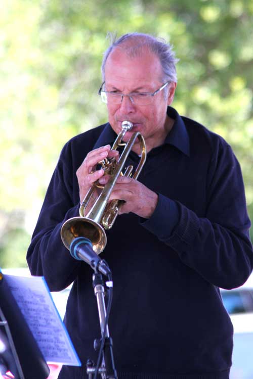
Alain, the band’s Trumpeter emailed to say the group would like to perform on Play d’eau click to enlargeWith Port La Forêt having no space for us on our return from Port Louis in Lorient, we had to forgo a treat we’d been looking forward to so much, for two months.
You may have seen the post we made about the Cornouaille Jazz Band. It was an unexpected delight to see them perform when we visited Port La Forêt on the south-bound leg of our cruise down the west coast of France in June.
We’ll meet again
Following our visit I was contacted by trumpeter Alain who graciously emailed me saying how much the group had liked the photos I had taken and given them before we left. Alain continued the email exchange by saying that if we returned to Port La Forêt the band would like to come and perform for us on Play d’eau!
How brilliant would that be? What major fun! We’d find a way to fit them on. Some in the aft cockpit, some on the flybridge roof – we’d make it work.
We were so looking forward to this and were planning to stock up with Pastis, biere et Cidre Breton.
Jazz on Play d’eau
Jazz on Play d’eau was bound to turn into a major pontoon party as well. There would be riot of boaters from all over the marina converging on the pontoon to see and hear the group. Raises the question of how many boaters does it take to sink a pontoon?
But it was not to be. Port La Forêt was full.
Maybe, just maybe
Our exploration of the west coast of France has shown us just how glorious and special this part of France is. So much so that we are considering whether to change our 2014 plans from the Baltic to another exploration of France. So much more to see and do.
Would Port La Forêt would have room for us next year? We wonder, we dream.
Meanwhile, our thanks must go to Alain and the Cornouaille Jazz Band for their kindness and willingness.
Piers and Lin
From the Saloon of Play d’eau
Fleming 55
You can get in touch with us any time by using our Contact Form.
Morning calm looking towards L’Aber Wrac’h’s estuary click to enlargeThree weeks ago when we left Rochefort, we had the distinct feeling we were starting our journey home; latitude was increasing and we were heading north – homeward bound.
The feeling became a reality yesterday on reaching L’Aber Wrac’h. Having turned the corner around the Brest peninsula we’d now track east along Brittany’s rock strew north coast.
‘The end is nigh,’ Piers said to Lin, dramatically. ‘Rubbish,’ was the immediate response. ‘It’s the start of the next stage of this whole adventure.’
Lin was right, of course.
There remain many delightful ports to visit along this coast and we can’t wait to see yacht Woolly Mammoth’s Graham and Frances in Jersey and together, have fun tormenting the local restaurants – again.
Pinch points
Threading our way through the reefs saved 30 minutes passage time click to enlargeWith no pinch points as such, we just wanted our easterly passage to Roscoff to be without hassle. If we could have the Atlantic swell behind us and a following tide and wind that didn’t interfere with us, that would be spot on.
The nav plan
Looking at the tide tables, if we left L’Aber Wrac’h at 0900 we’d catch the flood tide all the way to Roscoff.
The final stage of the route would require pilotage along the narrow Canal de Île de Batz separating Île de Batz from Roscoff, after which a turn to starboard would bring us to Roscoff’s new Bloscon marina.
The weather
Before departure, a SW’ly hushed at F2 whilst the sky above was half blue and half fractured cloud. To the east it was bright whilst to the west continuous dark cloud reigned supreme.The chart showing our route along the Canal de Ile de Batz click to enlargeThe cloud to the west signalled an approaching warm front, but the synoptic charts showed it wold slide SE taking its rain with it. We should run ahead and out pace it.
The journey
Another perfectly calm and flat sea awaited Captain Lin as she took Play d’eau off her pontoon and drove her out of the marina into the river, and headed for the sea. I was on warp and fender duty….
As ever, our planned route is always the safe route. Given it was calm and the tide was almost slack, we cut the corner by heading north through the rocks cutting off half an hour travel time.
There was nothing arduous on this passage. The tide and wind were with us, and the Atlantic swell gently caressed Play d’eau as we headed for the Canal de Île de Batz. A fleet of four small fishing boats here posed no threat – they simply made way for us.Large patches of weed were waiting to strangle our props and rudders click to enlargeThe only nuisance was the large amount of green weed at the entrance to the Canal. The issue with weed is that you never know what may be caught up in it. Netting? Rope? All designed to strangle your props and rudders and stop you dead in the water.
We carefully steered around the many clumps that blocked our way.
The Île de Batz looks simply delightful and has a number of small bays perfect for anchoring-out. One day.
Arriving
Turning to starboard to enter Roscoff’s approach channel, we slid by the docked Brittany Ferry busy disgorging its holiday makers onto French soil.
The Reeds Nautical Almanac helpfully, but somewhat unnecessarily, suggests small boats should keep clear of the ferries….
A few hundred metres on we entered the new Roscoff Bloscon marina and were met by a really helpful member of staff in his RIB. We were shown to the hammerhead of Ponton B.A Brittany Ferry in the commercial port next to the Roscoff Bloscon marina click to enlargeThe sun was out and it wasn’t raining. We’d beaten the warm front.
Another perfect cruise on another perfect day as we begin the next phase of our adventures.
The tecky details
Departed L’Aber Wrac’h – 0900
Arrived Roscoff – 1325
Time on passage – 4hr 25min
Total planned distance – 35.15nm
Tides: Neaps
Longest leg – 16.2nm from Aman Ar Ross NCM to Basse Plate NCM
We left Camaret in thick fog on weapons click to enlargeYes, yes, yes! Fog – and lots of it. Maybe 100m maximum.
So today we’d be on full weapons using our new radar seriously after all these hours of practising. And let’s not forget the Kahlenbergs and their auto-signaller for those four second blasts every two minutes.
One point to remember from yesterday’s passage was the port engine overheat. How would she (it? Non!) behave today? I had been into the engine room, talked kindly to her, stroked her and told her how much we valued and relied on her. In true HR style, I had no doubt she would behave itself.
The nav plan
Today’s pinch point would be the Chenal du Four as we made passage around the second part of the Brest peninsula. Needing to take this at slack tide meant being off Le Conquet at HW Brest +¼ or -5¾.Last time in L’Aber Wrac’H we drank biere. Now it’s Breton Cidre click to enlargeNot wanting to leave at silly’o’clock in the morning, we opted for the -5¾ point even though it meant we would be punching into a S’ly tide after Le Conquet. Mind you, it shouldn’t be too bad since it was neaps.
Our planned track from the Chenal would take us outside the coastal reefs, but if the seas were kind we could always cut corners and arrive significantly ahead of plan.
The weather
As we breakfasted, the gentlest of zephyrs was feeling its way around the marina, the fog creating an unreal silence, and over a coffee, we had a refresher of COLREG 19b. We felt prepared, nervous, yet excited.
The forecasts showed a maximum of a N’ly F2. With tides only a day away from neaps, the passage should be really smooth, even in the Chenal du Four.
Hollamby Portable Radar units
Whilst making a final check of the forecasts, three yachts with no radar and showing no lights left the marina. Not even one of those new Hollamby Portable Radar (HPR) units was in sight. Here, we’ll refrain from making further comment.
The journey
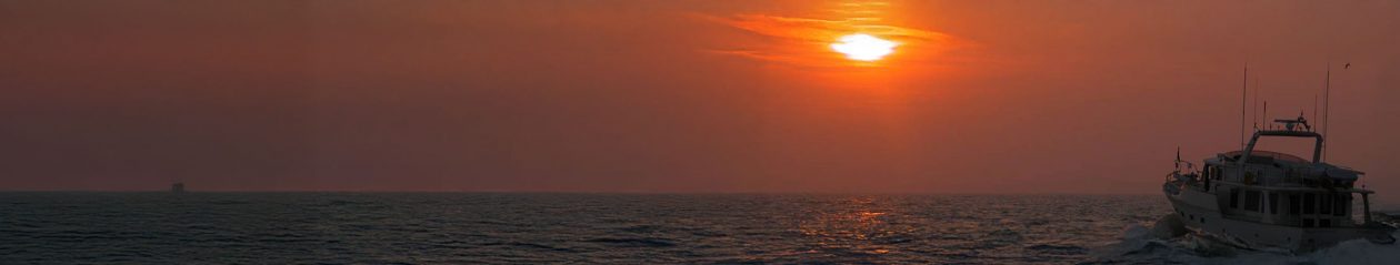
Easing off the pontoon we felt our way out of the marina and soon lost sight of land. Activating the Kahlenberg auto-signaller, I reminded Lin the horns were just about to fire.A beautiful sky and sunset displayed itself as we bade farewell to the west coast of Brittany click to enlargeThey did, and despite the warning, we both jumped. In fact, even though we knew they’d keep firing every two minutes, we couldn’t stop ourselves from jumping every time. But the glorious rich and loud sound they gave made every jump well worth it.
The radar was simply brilliant. Seagulls, whether swimming or flying, and pots, were all identifiable. Boats from small Merry Fishers to high speed Vedettes could all be tracked and it was so useful to see their relative, as well as true, vectors.
The Chenal was flat calm. Trusting our radar, chart plotter and its back up, we passed close to the Le Four lighthouse specifically to take some photos through the fog.
Targets in the fog
Interestingly, although there was little traffic on the water, we didn’t have to alter course for any boats, only pots. Boats seemed to change direction and move out of our way.The Le Four lighthouse hiding in the fog click to enlargeWe wondered if it had anything to do with the Kahlenbergs….
Arriving
With an hour and a half to run, the fog lifted revealing blue skies and perfect visibility. Taking as many short cuts as we could and arrived at L’Aber Wrac’h some 50 minutes ahead of plan.
Did the port engine behave herself? Admirably.
The tecky details
Departed Camaret – 0902
Arrived L’Aber Wrac’h – 1454
Time on passage – 5hr 19min
Total planned distance – 36.05nm
Tides: 1 day before Neaps
Longest leg – 7.4nm from Pointe de Grand Goven to Roche de La Dorade
Tech issues – nil
Incidents – nil
Navigational info: As in the previous leg, be at the Chenal du Four at neaps, slack tide, and a wind less than F3The Petit Pot de Beurre ECM in the estuary to L’Aber Wrac’h click to enlarge
Piers and Lin
From the Nav Table of Play d’eau
Fleming 55
You can get in touch with us any time by using our Contact Form.
The Brest peninsula is the gateway twixt Brittany’s west and north coasts around which the Atlantic rushes in its desperate attempt to reach the North Sea before time is called for it to turn around and dash back some six hours later.
Pinch points
The peninsula has two pinch points through which it’s sensible, if not vital, to pass at just the right time to avoid meeting unpleasant seas – the Raz de Sein and Chenal du Four.
Get it right and both are as placid as can be. Get it wrong and there’s many a heart stirring video on You Tube to demonstrate just how nasty they can be.
The best plan is to take them during a period of neaps (least water volume flowing between high and low tide), slack tide (movement of the sea changing direction and is virtually stationary for a short time), and calm wind (so the sea isn’t whipped up).
The chart showing Play d’eau and the start of the route to Camaret click to enlarge
The Raz de Sein (pronounced Ra de Senn) would be the pinch point in today’s planning.
The nav plan
It was only two days before neaps which ticked one box. Slack tide in the Raz would be at 0946 or 1601 and since it would take some seven hours to reach the Raz, we chose 1601. That ticked the second box.
Aided by the Admiralty Tidal Steam Atlas for the west coast of France (NP265), we worked backwards arriving at a departure time from Sainte Marine of 0902.
The weather
Sainte Marine was calm with clear skies and good visibility. The forecast wind for the Raz de Sein was N’ly F3 thereby ticking the third and last box.
We followed two small fishing boats as we left the estuary and motored into the bay click to enlarge
‘Perfick,’ as Pop Larkin would say in the Darling Buds of May.
The journey
It started as one of those rare sunny days. Nil wind had encouraged the sea to look like silken glass. Not a ripple nor even a ‘riplet’, and with a distant haze it was hard to distinguish the horizon between sea and sky. Surreal.
We left the marina following some small fishing boats out of the estuary and into the bay.
After hours of glorious cruising the journey through the Raz presented Play d’eau with only a slight chop created from a N’ly F3 blowing over the slack tide.
However, as soon as we through, the wind obviously wanted to annoy us and increased to F5 and joined forces with the Atlantic swell on our port beam to create an uncomfy but not horrid, corkscrewing motion for the next hour. Hmmm.
A silken flat calm sea with the horizon barely distinguishable click to enlarge
Engine overheat
As if to compound this movement, soon after we rounded the Raz de Sein, the port engine water temperature rose from its normal 160F to 210F.
Leaving the engine idling in neutral, Lin took control as I disappeared into the engine room armed with our ‘point and shoot’ thermometer to compare the main cooling elements of both engines. I could find no significant difference. The most likely cause was a faulty instrument, yet that might prove to be too easy an answer.
Playing it safe, we shut the engine down, only starting it as we entered Camaret to aid manoeuvring. It showed no signs of overheating.
Arriving
As we turned east around Pointe du Toulinguet on the final leg to Camaret, the sea quietened to its original flat calm and we arrived in Camaret in hot sunshine.Entering the Raz de Sein keeping both La Plate (left) and La Vieille to starboard click to enlargeA hour later, Brian of yacht Morning Spirit, with whom we’d previously had such a great evening in Pornic, pulled into Camaret as well.
The tecky details
Departed Sainte Marine – 0902
Arrived Camaret – 1746
Time on passage – 8hr 44min
Total planned distance – 57.4nm
Tides: 2 days before Neaps
Longest leg – 22.4nm from Cap Caval WCM to Pointe La Plate WCM
Tech issues – port engine cooling overheat, cause unknown.
Navigational info: Take the Raz de Sein at neaps, slack water and a wind below F3.
Piers and Lin
From the Nav Table of Play d’eau
Fleming 55The coast guard’s HQ on the Pointe-de-Toulinguet click to enlargeQuestion: Which Boulangerie will win the great Croissant Competition this cruise? Watch this space….
You can get in touch with us any time by using our Contact Form.
Play d’eau catches the early morning sun at Port Louis click to enlargeThis was a perfect journey. So gentle, so beautiful.
Why Sainte Marine when we had planned for one our favourite marinas, Port La Fôret? Vendée Globe racing yachts had filled the marina leaving no room to spare for Play d’eau, but Sainte Marine opened their arms to us.
The nav plan
Todays’ cruise had no pinch points. The wind would be from the N and NE and we’d be fully protected from it by the land.
The weather
A good forecast became reality. No complaints.
The journey
So we left Port Louis in warm, full sunshine with clear skies above and the N’ly wind behind us. We reversed from our mooring between the pontoon and the trawlers, turned to starboard and headed into the calm water of Lorient harbour.Dawn was still breaking as we reversed between the pontoon and the trawlers click to enlargeThe journey was uneventful apart from one trawler returning to its home port and one small fishing boat. We suspect neither had seen us, being too intent on counting their catches. Being once bitten twice shy, both had five blasts and altered course immediately – Kahlenbergs work really well!
Arriving
Arrival was simplicity itself. A call on Canal Neuf giving a five minute warning and one of the Capitainerie’s dory’s was by our side to show us to our mooring. So helpful.
Looking around, we’d forgotten the area is so pretty and delightful. Sainte Marine is on the west side of the river Odet, Benodet on the east side.
Motor Cruiser Tranquil Light
Would you believe, a boat we’d first met at Sainte Marina three years ago, and which had seen us seen in Port Haliguen was moored in front of us.Martin and Joyce and their Prestige 46 Tranquil Light click to enlargeMartin and Joyce of Tranquil Light, a Jenneau Prestige 46, had been cruising the west coast of France since May and are only now on their way home.
Martin brewed a luscious Cappuccino and Joyce presented some great mini-macaroons. We know who to visit for elevenses, afternoon tea, after dinner, hmmm – anytime….
The tecky details
Departed Port Louis – 0931
Arrived Sainte Marine – 1511
Time on passage – 5hr 40min
Total planned distance – 35.0nm
Longest leg – 17.0nm from Les Trois Pierres to Corn-Vas WCM
Tides: Midway twixt Springs to Neaps
Tech issues – nil
Incidents – nil
Navigational info: The river Odet flows at 4kts at springs which catches so many boaters unaware when mooring.
Piers and Lin
From the Nav Table of Play d’eau
You can get in touch with us any time by using our Contact Form. The trawler that altered course 70 degrees to avoid us. Kahlenbergs work brilliantly click to enlarge
Our ‘inaccessible by land’ river pontoon at La Roche Bernard. The only other habited boat moored alongside us click to enlargeWe’d had a brilliant six days at La Roche Bernard, not the least because we met Chris and Sue of Yacht Aquitaine again, whom we’d first met in Vannes.
The forecast was good but reality was to prove very different for our journey to Lorient.
En route to Arzal lock
0530 and the alarm woke us from a deep sleep. As I struggled to prise my eyes open I was thinking of good reasons not to go, but a strong cup of coffee from Lin soon put paid to the ideas.
Stepping out of the saloon to sniff the weather, total cloud cover drew blinds on any light from the night sky; so different from the previous night when clear sky allowed a huge full moon and countless stars to light the valley as clear as daylight. A NW F2 breeze ruffled wavelets in the river. The air felt damp. Silence was being broken as terns woke and began chirruping the first calls of the morning.Before dawn broke, the FLIR thermal image showed three yachts on mooring buoys and the Roche of La Roche Bernard behind them click to enlargeThe plan was to leave La Roche Bernard at 0700, head downstream to Arzal and take their first lock of the day at 0800.
Our 200m river pontoon was home to only one other inhabited boat which had chosen to be immediately next door to us. Wanting to be quiet we waited until 0640 to crane the dinghy onto the saloon roof. In the remnants of the night’s cloak the crane’s motor screamed as it lifted ‘T/T Play d’eau’ at which point the yacht’s two man crew popped out of the cabin, thanked us for the alarm call and made ready to cast off for the same lock as ourselves.
The nav plan
Today there were no pinch points to worry about and the plan was straight forward. As long as the weather played its part, or more accurately, as long as the forecasters were on our side, there’d be no problems at all.
The weather
The forecasts and synoptic charts showed the wind being N/NW F4 becoming N/NE F4/5 as the fronts passed.
This would be perfect and coincide with our plan to traverse the Teignouse channel through the reef at the base of the Quiberon peninsula, separating the Baie de Quiberon from the Atlantic Ocean.At the Arzal sluice barrier the Cormorants were waiting for breakfast click to enlargeGiven we’d be on a 1kt falling tide (helping us along), the NE’ly meant the wind wouldn’t be against us. If it had been it would have created a classic wind against tide scenario, building waves and swell, made worse as the sea funnelled through the channel over the reef.
The journey
As dawn’s light began to penetrate the clouds, we cast off, bid La Roche Bernard farewell and meandered gently downriver to Arzal’s Lock where we waited only ten minutes before it opened and allowed us to enter.
About an hour after leaving the lock and wending our way to the sea, it seemed the wind was probably a notch stronger than forecast but nothing worth being concerned about in the least.
Three and a half hours later as we neared the Quiberon peninsula, Lin and I had been urging the wind to be as forecast but it stubbornly refused to budge. As if to dig its heels in and show just how belligerent it could be, it backed to W’ly and increased to top end F5 and edged into F6.Waiting for the lock gates to open to let us out to the tidal part of La Vilaine river click to enlargeThis created a 1½ mile stretch of somewhat challengingly large and steep waves over the reef giving Lin and I the dubious pleasure of one moment seeing the sky, the next the ocean floor, then the sky again and the ocean floor again, as Play d’eau rode the bronco for the next fifteen minutes.
Once through the reef and heading NW to Lorient, the sea calmed to a gentle Atlantic swell and we could breathe again.
A blessing
Nearing Lorient and some three miles east of Île de Groix, we espied a flock of cormorants swimming on the water, which, on closer inspection was a small school of dolphins, playing and jumping! How brilliant was that?
Our unpleasant memories of the Teignouse channel roller-coaster just evaporated.
Arriving
Halfway to Lorient, the sea behind us was agitated and the remnants of a front hung over a lone yacht click to enlarge
The entrance to Lorient is a really narrow 135m wide from zero contour to zero contour. Since it was absolute low tide it was even less. Traffic was reasonably dense in both directions with many yachts and small fishing craft. To keep ‘in the flow’ Play d’eau was at idle and 5 knots. Sensibly, sail boats were pulling their sails down before entering the channel and running in under power.
There had to be one…
But there had to one, didn’t there, who insisted on entering the channel under sail alone. Not a problem in itself, but a potential problem. He’d been overtaking other boats and was now some 75m on my port side. All was well until the high walls of the ramparts to our starboard took his wind whereupon he immediately turned straight for me.
Nearing the Lorient entrance we kept to starboard ready to take the next channel to Port Louis I pulled all power off hoping he’d pass in front. Turning to starboard wasn’t an option; I was already as far to starboard as possible ready to turn into the next channel for Port Louis marina. click to enlargeTurning to port would have hit him. Engaging reverse power would have taken far too long to effect Play d’eau’s 35 tonnes of inertia, as would increasing forward power to accelerate. Even with fresh wind in his sails he kept on coming straight for me. Coming into ear shot he shouted ‘Give way! Sail!’.
What could I do? Evaporate? Almost hitting us and just before going about, he shouted, ‘You should plan and anticipate. We have sail.’
I felt like bellowing ‘9b’ (sail doesn’t have right of way in a narrow channel where a craft is restricted in its ability to manoeuvre) but was so stunned at his arrogance, I didn’t. It should have been he who planned and anticipated, not me. Where’s the Gattling gun when you most need it?
However, in complete contrast, a delightful and welcoming girl from the Capitainerie came out in a dory to greet us and shepherd us to our berth. Just as earlier with the dolphins, it’s so good that a blessing can ameliorate a growl-inducing event.
Peace descended, and we forgave the forecasters.Port Louis the next morning. Peace reigned as dawn broke click to enlarge
The tecky details
Departed La Roche Bernard – 0710
Arrived Arzal lock – 0754
Departed Arzal lock – 0824
Arrived Port Louis – 1534
Time on passage – 8hr 24min
Total planned distance – 55.3nm
Longest leg – 17.8nm from Basse des Mats to NE Teignouse SHM
Tides – almost midway from Springs to Neaps
Tech issues – nil
Incidents – ‘There had to be one…’
Piers and Lin
From the Nav Table of Play d’eau
Fleming 55
You can get in touch with us any time by using our Contact Form.
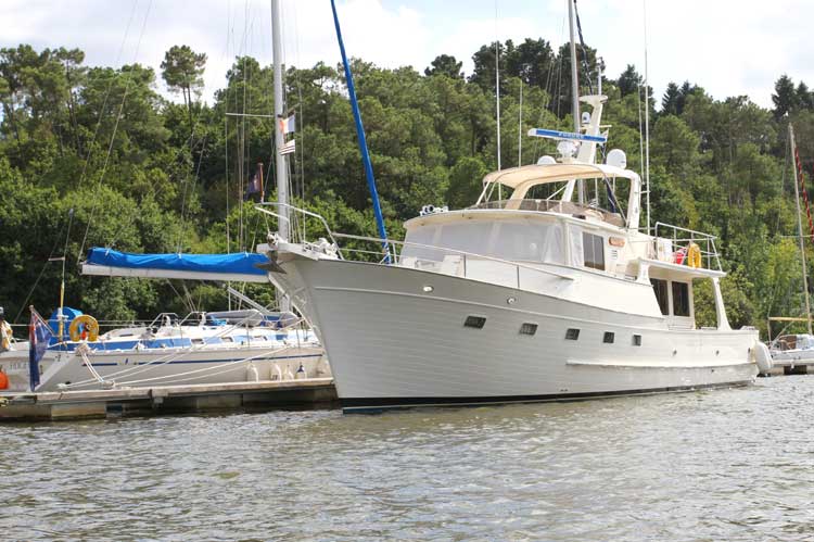
These were the voyages of Piers and Lin du Pré aboard their Fleming 55


 forbid exit")


 and La Vieille")