8am this morning, and endless black clouds and high winds assail us click to enlargeOwn up – who turned our brilliant weather off?
The 6 weeks following our departure from Audierne on 12th June have been utterly glorious. Sun cream by the gallon (well, not quite), calm seas and blue skies, all courtesy of a friendly Azores high pressure system spreading its wings over Play d’eau. It was perfect.
But the moment John and Beryl left nine days ago, we’ve had thunder storms and high winds created by an endless march of depression after depression which have won the battle and sent the high pressure running.
Where now?
Good question. So far we’ve been holed up in Les Sables d’Olonne for six days and the first weather window seems to be next Thursday. If so, we’ll have been in Les Sables for nine days when we only intended one.
Our plan had been to visit Île d’Yeu, Pornic, Roche Bernard in the La Vilaine River, anchor off one of the beautiful, small islands of the Quiberon Peninsula, moving onto Lorient, the Glénans archipelago known as the Breton Tahiti, and finally Port la Fôret before heading for Camaret on the Finistère Peninsula on or around 9th August.
Looking further into the forecasts brings even more depressions. Growl.
Battle plan
Well, two can play at this weather game. So, planning for the worst, rather than seven stops en route to Camaret with time off to play at each, we’ll do it in three. Pornichet, Lorient and Sainte Marine, taking any available weather window.
Meanwhile, if another high pressure graces us with its presence and banishes the depressions, we’ll stay and play. If it doesn’t, at least we know ‘the plan’.
You see, there’s always next year….
Piers and Lin
from the Meteorological Observatory of Play d’eau
Fleming 55
The falling spring tide would bring today’s special challenges. The gorgeous 23m yacht Copihue left Pornic half an hour before us click to enlarge
La Vilaine River
La Roche Bernard is some 10nm up the beautiful La Vilaine river. Just beyond midway is the Arzal lock and the 1400 écluse would be perfect – if the planning allowed it.
The nav plan
The first challenge was the time to leave Pornic before the spring tide had fallen to a level where the silted marina approach channel would be too shallow for our safe exit to the Baie de Bourgneuf.
The second was the mouth of La Vilaine which has sand bar 2nm long at its ‘embouchure’ reducing depth only 0.5m above chart datum.
Planning showed that if we left Pornic as the latest safe time and kept our speed to 7kts (using one engine only to save servicing time) we’d arrive at the mouth to La Vilaine as the tide was on the rise giving us an extra 1.5m above chart datum. Adding that to the chart’s 0.5m would give 2m. Since Play d’eau’s draft is 1.52m, she’d have 48cms under her keel.We motored through a shoal (a wobble?) of these huge 2′ diameter jelly fish click to enlargeWell, that was the theory which we knew would be subject to many factors such as additional silting, atmospheric pressure, wind effect and so on, but we could test this as we approached the mouth by monitoring chart soundings against the depth sounder. Dead slow at this point just in case.
The weather
A NE F3, clear skies and excellent visibility greeted us when we woke at 0630. Even if the wind had been much stronger it wouldn’t have mattered since the land would be there to protect us.
Preparation included Lin going to the Capitainerie to use their wi-fi (wee-fee) to download emails only to find the Capitainerie wasn’t open but the laundry was. Perching the laptop on the washing machine – ‘le wee-fee marshed’ as they say in French.
The journey
Lin took Play d’eau off her berth at our ETD of 0754 and manoeuvred her towards the entrance. A sharp turn to starboard took us into the approach channel, the depth was just right, and we were into the Baie de Bourgneuf.Approaching Arzal lock, about half way from the sea to La Roche Bernard click to enlargeTravelling close to the Jade Coast our journey took us past the Pointe de St Caldas and into the Grande Rade de La Loire.
Crossing the approach channel to St Nazaire Lin was reminded of her Dad’s involvement on the raid on the lock gates of the Normandie dry dock in WW2. He was on the hunter destroyer, HMS Atherstone, and his account of the Atherstone’s involvement differs significantly from that in the text books….he lived to tell the tale and have five children, one of which, of course, was Lin.
From Point du Croisic with its shoal of jelly fish (or is it a ‘wobble’?) to Piriac-sur-Mer, we passed the small bird sanctuary and mussel farms of Île Dumet to port before heading for the mouth of La Vilaine.
The whole journey was so, so pretty.
’Bonjour La Vilaine’
At her shallowest point, La Vilaine’s sand bar gave us 1m clearance below Play d’eau’s keel. We thanked her.We entered the Arzal lock stopping before the lifting bridge took our mast off! click to enlargeLa Vilaine is a beautiful river. Leaving the mussel farms behind and the dark green tree lined banks ahead, we wove our way towards the lock at Arzal.
Arzal Lock
The timing worked. The lock was open as we approached and the lights were green. We entered, stopping before the road bridge which spanned the lock. We looped the hanging chains with our warps and a few minutes later we began the 2m rise.
Given Play d’eau’s air draft, the lifting bridge was raised and we exited.
Arriving
The next 4nm to La Roche Bernard reminded us of the beauty of La Sein when we cruised to Paris in Play d’eau in 2004. For sake of repeating ourselves, the river’s beauty has to be seen to be believed. The lifting bridge had to be raised before we were able to exit the lock click to enlargeGiven our length we had to moor on the visitor’s pontoon which itself is moored in the river. Access to the shore is by a small dory and pulling a rope on a pulley system. The 200m journey takes for ever, is hugely exhausting but the macho in a chap prevents fatigue from showing.
The tecky details
Departed Pornic – 0754
Arrived Arzal lock – 1355
Departed Arzal lock – 1415
Arrived La Roche Bernard – 1448
Time on passage – 6hr 54min
Total planned distance – 45.8nm
Tides: Spring
Longest leg – 11.9nm from SE Lambarde SCM to Pointe du Croisic
Tech issues – nil
Incidents – nil
Navigational info: La Vilaine carries considerable amounts of silt, mainly mud. The marker buoys are moved often to reflect this, and the chart bears no relation to reality.
Piers and Lin
From the Nav Table of Play d’eau
Fleming 55
You can get in touch with us any time by using our Contact Form.La Vilaine river between Arzal and La Roche Bernard click to enlarge
La Vilaine river between Arzal and La Roche Bernard click to enlargeLa Vilaine river between Arzal and La Roche Bernard click to enlargeVedettes ply La Vilaine click to enlargeThere are some lovely houses on La Vilaine click to enlargeThe dory links the pontoon with the shore. You pull on the rope and pull yourself along – exhausting! click to enlarge
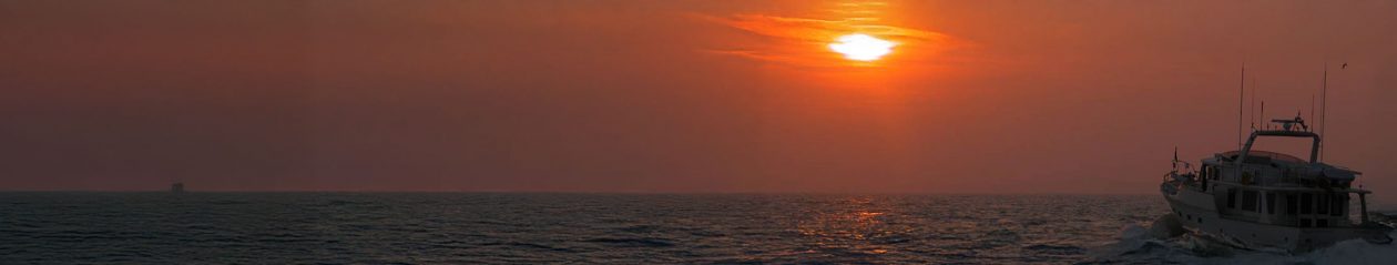
A lovely calm sea for the cruise to Pornic click to enlargeLooking forward to another FLIR experience, we cast off from Quai Garnier’s pontoon A ‘exterieur’ and headed into the black an hour and a half before sunrise, destination Pornic in the départment Loire Atlantique, some 60nm to the North.
Even with clear skies there was no moon. Maybe, because today’s a French public holiday, apparently something to do with Napoleon being officially recognised as a ‘good egg’, the moon had taken its own day (or night) as an Astronomic public holiday.
The nav plan
The pinch point was the latest time we could safely enter Pornic given the continuous silting it suffers in its approach channel.
I’d called the Capitainerie and Mademoiselle said she’d reserve a place for us. ‘Have you been here before?’ I was asked. ‘You must stay close to the rouge, the red channel markers, where it’s OK for you.’
We planned the north bound route to go anti-clockwise around the outside of the reefs surrounding Île de Noirmoutier rather than risk cutting through the narrow gap at its southern extremity and the mainland. Numerous published warnings advise not trying and although that to me is like a red rag to a bull, I agreed.
The route kept us some 5nm off the coast but there were large areas where the seabed rose to within the 10m depth contour. That would mean pots, lots of pots, and dozens of fishermen in their Merry Fishers hoping for a fresh catch for lunch and always somehow being directly in our way.
We weren’t to be disappointed.
The weather
With a gentle wind mainly from the E, and flat calm seas, we were completely protected by the land. The skies were clear, no moon (have I mentioned that?), and the visibility was perfect.Our new Furuno FAR2117 picks up pots so well. The 4 strong returns ahead and port were pots, the three small light yellow returns ahead were gulls, and the long blue trail pointing 030 degrees was a helicopter we tracked doing 69kts click to enlarge
The journey
The moment we passed over the 10m contour, pots were everywhere with clusters of ten being common. However, in the main they were well flagged and visible.
But deceptive. On this, our 15th passage since we left Guernsey, we came across our first net. At first, it looked like two more clusters of pot markers about 300m apart. Aiming to pass between them we saw, too late, a line of small white floats, maybe 10cm diameter and each 30m apart.
‘Net!’ I shouted as I pulled the throttles to idle and the gears to neutral. ‘Watch the floats as we go over them,’ I called to Lin.
We coasted and waited. Would I have to dive to cut ourselves free? Would our rope cutters work? I waited as Lin watched from the side of the Pilot House.
After an age, Lin shouted, ‘Looks like they’re not following us – we’re OK.’ I waited a few more moments just to be sure before engaging the gears and opening the throttles again. We’d had our first ‘net experience’.
Not knowing how nets are cast, I suspect each float has a line which suspends the net a few metres below the surface. We’d passed over the top.
Cruising up the west coast of Île de Noirmoutier it was just about high tide giving us some 4.5m above chart datum, confirmed by comparing the depth sounder against a sounding on the chart and the embedded local tide tables in our Furuno nn3d chartplotter.
‘If you’re OK with cutting the north western corner and passing through the reef, we’ll do it,’ I said the Lin. Looking at the chart, the calm sea and perfect visibility, the only issue would be pots and the fishermen. ‘We can dodge the pots, and for the fishermen we have Kahlenbergs – they don’t – and a black water tank,’ I added.
Sadly, we didn’t have to use the horns, not even once, but cutting the corner saved some 3.5nm and 25 minutes, putting us exactly on the best time to arrive at Pornic.Dozens of small boats were out fishing over a shoal bank just N of Île de Noirmoutier click to enlarge
Arriving
Leaving Île de Noirmoutier behind we entered the Baie de Bourgneuf of the Grande Rade de la Loire, and headed ENE straight for Pornic.
Pornic looked lovely. Large, beautiful villas lined the coast. Mature pine trees were everywhere, from which it earned its name of the Jade Coast.
Keeping close to the red port hand channel markers, we entered the marina and saw Mademoiselle in her dory waiting to take us to our berth. Perfect.
We intend to stay here a few days giving us plenty of time to explore.
The tecky details
Departed Les Sables d’Olonne – 0536
Arrived Pornic – 1249
Time on passage – 7hr 13min
Total planned distance – 59.9nm
Tides: Neap
Longest leg – 21.7nm from Basse Vermenou to Pont d’Yeu SCM
Tech issues – nil
Incidents – 1. The net.
Piers and Lin
From the Nav Table of Play d’eau
Fleming 55
You can get in touch with us any time by using our Contact Form.
These were the voyages of Piers and Lin du Pré aboard their Fleming 55

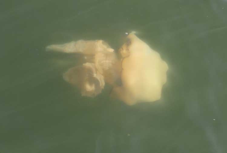

 of these huge jelly fish")