
and motored east along the narrow channel
click to enlarge
Exiting the lock, we waved goodbye to the lock-keeper, headed out of the harbour and into the long, narrow channel.
The weather
After days and days of high winds that kept us safely tucked up in Paimpol’s Basin 1, today’s wind was almost non-existent. It was so calm, registering a gust maximum of 0.26kts on Play d’eau’s instruments.
OK, the sky was full of murky cloud but there was no rain and the temperature was ‘good to go’. So we did.
Pinch points

click to enlarge
Tide Plan 2
The longest leg is 32.7nm. For this, we’d use Tide Plan 2, a software which plans a constant heading to steer between waypoints, ensuring the tidal flow is put to best advantage (or least disadvantage) giving the best time on the leg.
Note: the software can be downloaded for trial, free of charge, from CompassCard.
The nav plan

click to enlarge
The journey
Piloting through the Chenal Saint-Rion was fun. The spring tide was having a ball, dancing a Viennese waltz around the small islands and rocky seabed, its turning and swirling causing the autopilot to work overtime to keep us on track whilst coping with an additional 3.7kts of tide.
Arriving at the Nord Horaine NCM, we set the autopilot to Tide Plan’s calculated heading of 077 (T) for our next waypoint just south of Les Grunes Vaudin on Danger Rock Passage.
recorded our arrival into La Collette
click to enlarge
Arriving
TidePlan 2 had done a reasonable job, putting us back on track just 2nm before the waypoint. It was now low tide, giving us just 1m above chart datum.
Calling St Helier marina we were told there was Dragon Boat racing in the main harbour and that we’d have to pull into the adjacent La Collette harbour and wait on D pontoon. ‘Follow the dory,’ was the Harbour Master’s advice. ‘It’s a very low spring tide and the channel to the pontoons is narrow.’ Shades of Paimpol, I wondered? At one stage Play d’eau only had 60cms beneath her keel.
It would be 2½hrs before we could leave and motor the half mile to the St Helier marina. We used the time to give Play d’eau a bath, reset clocks to UK time and change SIMs on our mobiles.
Whilst we paused for a few moments to have some hot chocolate, we looked at each other and said, ‘Nearly home.’
The tecky details

and arrived at St Helier marina at 1745
click to enlarge
Arrived La Collette – 1515 (UK)
Time on passage – 8hr 30min
Total planned distance – 47.5nm
Tide: Top of springs
Longest leg – 32.7nm Nord Horaine NCM to
Tech issues – nil
Incidents – nil
Navigational info: The approach into La Collette requires a hard turn to starboard to go between the mole and the PHM. Track close to the fishing boats to starboard before heading to the pontoons to port.
Now, where’s Woolly Mammoth?
Piers and Lin
From the Pilot House of
Play d’eau
Fleming 55
You can get in touch with us any time by using our Contact Form.
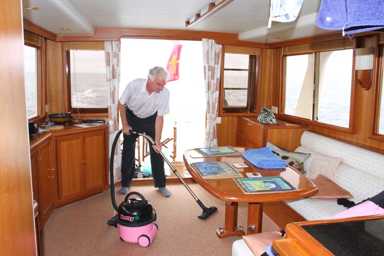
 Piers began doing the housekeeping… click to enlarge |
 took her position in the driving seat click to enlarge |
 click to enlarge |
 restored us on track just 2nm before the waypoint click to enlarge |